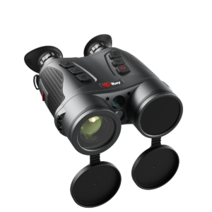
DR106 Sniper Auxiliary Training System
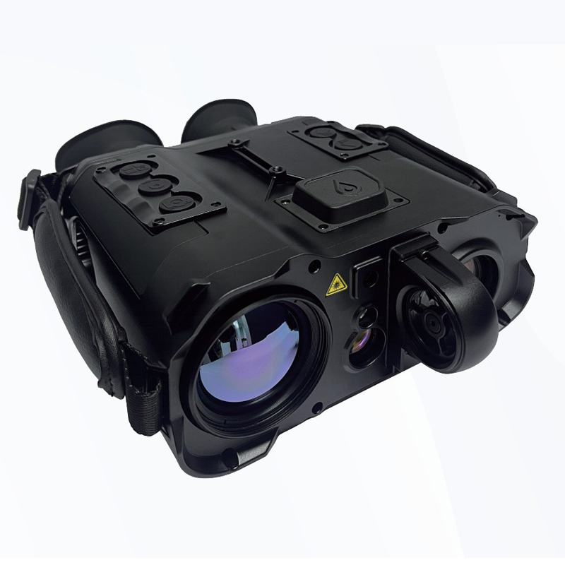
The DR106 sniper auxiliary training system integrates thermal imaging and visible light imaging functions. It is an intelligent observation system that enables all-weather aiming and real-time collection of shooting-related meteorological data for ballistic calculation, thereby assisting shooting. This product can also be used as a general reconnaissance equipment for observing the battlefield up close during day and night, identifying targets such as personnel, vehicles, and terrain,thereby enhancing observation and improving shooting effectiveness.
Description
DR106
TelescopeSniper Auxiliary Training System
The DR106 sniper auxiliary training system integrates thermal imaging and visible light imaging functions. It is an intelligent observation system that enables all-weather aiming and real-time collection of shooting-related meteorological data for ballistic calculation, thereby assisting shooting. This product can also be used as a general reconnaissance equipment for observing the battlefield up close during day and night, identifying targets such as personnel, vehicles, and terrain,thereby enhancing observation and improving shooting effectiveness.
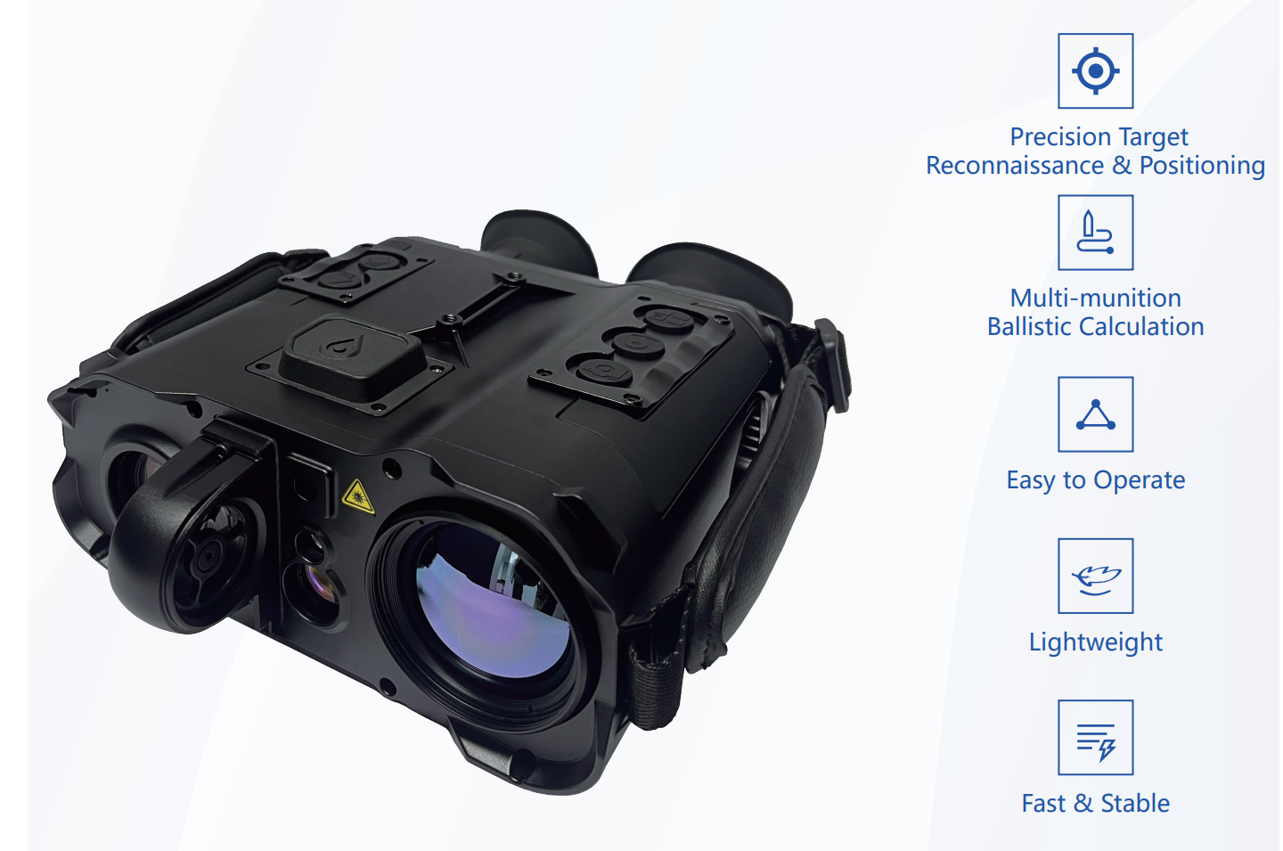
Application
Ballistic calculation, battlefield reconnaissance, target localization, surrounding mapping, etc.

Features
| Precision Target Reconnaissance Positioning |
| Self-positioning horizontal accuracy ≤±3m |
| Target positioning accuracy ≤±20m |
| Multi-munition Ballistic Calculation |
| Measure meteorological parameters such as temperature, humidity, and atmospheric pressure. |
| Including 267 types of ballistic parameters (customizable) |
| Adjustable for wind deflection |
| Easy to Operate |
| Interface functionality operation guide |
| Human-machine ergonomic design Lightweight |
| Compact size: 210mm*178mm*75mm |
| Lightweight: 1.75kg(with battery) |
| Fast & Stable |
| Non-cooled, rapid startup ≤30s |
| Working Temperature:-40℃~+60℃ |
| IP67 protection level |
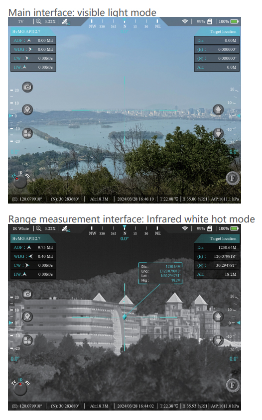
Specification
| Image Mode | |
| Visible light | |
| Infrared thermal image Visible Light | |
| Visible Light | |
| Resolution | 1920*1080 |
| Target surface dimensions | 1/2.8 in |
| FOV | 40°*32°~0.35°*0.28° |
| Infrared Thermal Image | |
| Resolution | 640*512 |
| Pixel Pitch | 12μm |
| FOV | 8.8°*7.0° |
| Laser Rangefinding | |
| Laser wavelength | 1535nm |
| Measurement range | 30m-3Km (Vehicle) |
| Positioning Component | |
| Positioning mode | BeiDou/GPS/GLONASS multi-mode |
| Electronic Compass | |
| Azimuth accuracy | 0.2° (RMS) |
| Pitch angle accuracy | 0.1°(RMS) |
| Intelligent Automatic Correction of Magnetic Declination | |
| Automatic identification of local magnetic declination (at the specified location), eliminating the need for manual correction. | |
| Ballistic Calculation | |
| Ballistic input | Support for custom input |
| Number of ballistic profiles stored | 10 groups |
| Wind deflection accuracy | 0.05mil |
| Shooting angle accuracy | 0.05mil |
| Meteorological sensor | |
| Temperature range | -40℃~+60℃ |
| Humidity range | 0%RH~100%RH |
| Pressure range | 200hPa ~ 1100hPa |
| Wind speed range | -25m/s~+25m/s("+/- indicates wind direction) |
| Working Time | |
| Continuous working time ≥5 hours, @25℃ | |
| External Interfaces | |
| DC/USB/PAL/RS232 | |


